**The speed record is held by the Swiss P.A. Gobet. He ran from the centre of Chamonix to the summit and back in 5hr10mins!
Most 'normal' people take 2 days and use lifts and trains to cheat the first few thousand metres!
Best months to climb: March, April, May, July, August, September
Mont Blanc Summit - Geographic co-ordinates: 32T E 0334 118 N 5077 668


Climb the Mont Blanc during the summer months
** Advance booking is ESSENTIAL in the high mountain huts/refuges - summer months are very busy!
To climb the Mont Blanc from Chamonix, people normally choose one of the two most common routes.
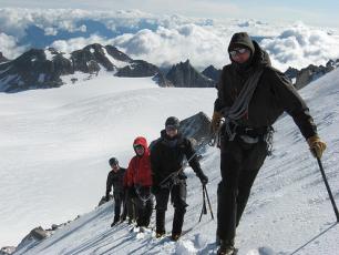
Gouter Route: This is the classic and most popular route to climb Mont Blanc and is VERY busy.
It is a slightly easier and a more reliable option via the Bellevue cable car from Les Houches, then take the Tramway du Mont Blanc to the Nid d'Aigle, then up the Aiguille du Gouter and the Bosse ridge. Keep in mind you need to book the Gouter Refuge in advance and it gets very crowded.
Day 1: Take the Bellevue cable from Les Houchesand then the Tramway du Mont Blanc to the Nid d'Aigle (2,372m)
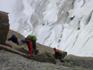
From here to the Gouter Refuge there is about 5hours of walking/scrambling. The first section is easy walking terrain on a well established path but after the Tête Rousse refuge you have to cross the infamous Grand Couloir where there is often rock fall from above. The last 550m is not easy (especially on the descent when you are more than likely going to be tired) and involves scrambling rather than walking. Overnight at the Gouter Refuge
Day 2: Wear your crampons after you leave the Gouter refuge - you are now on glaciated terrain!
Most of the ascent is long and slow without any steep ground to cover.
Walking past the Vallot hut (an emergency bivouac) to the summit of Mont Blanc - climb along the Bosses Ridge (the two humps which form the distinctive skyline seen from the Chamonix valley). This is an exposed ridge,often very icy and which requires good crampon technique and concentration
To descent you can either go down via the Aiguille du Midi or reverse the route taken. The 2,436m descend to the tram station at Nid d'Aigle requires extreme care and steady footwork as the descent is very exposed.
Ideal period: March to September (depending on weather conditions)
Ascent: 4-5hours / Descent:
Difficulty:
Gouter Refuge: Geographic co-ordinates: 32T E 0331 510 N 5080 139 / Altitude - 3,817m / Open: from June to September / 6hours from Nid d'Aigle / Reservations Tel: +33 (0)4 50 54 40 93
Tête Rousse Refuge: Geographic co-ordinates: 32T E 0330 590 N 5080 275 / Altitude - 3,167m / Open: from June to September / 3hours from Nid d'Aigle / Reservations Tel: +33 (0)4 50 58 24 97
Cosmique Route: This route is slightly more demanding; both physcially and technically compared to the Gouter Route.
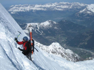
The route from the Aiguille du Midi over the Mont Blanc du Tacul and the Mont Maudit is generally quieter and highly dependent on the conditions. There are areas of steeper ground and a couple of traverses that may be icy and difficult. Good crampons and ice technique are essential!
Take the cable car to the Aiguille du Midi (3,842m) and from here descend to the Aiguille du Midi arete to the Glacier du Tacul and from here there is approximately another 1 hour walk on easy terrain to the Cosmique Refuge (3,613m) - Overnight here.
The following day start your climb to the Mont Blanc du Tacul - this ascent can prove difficult at times due to the ever increasing warm temperatures in recent years more crevasses have opened up and at times requires climbing on some steep exposed terrain.
After reaching the shoulder of the Mont Blanc du Tacul, descend and traverse to the Col du Mont Maudit, then ascend a long snow slope to the final piece of technical ground which can be very steep, requires good front pointing technique and the use of an ice axe.
Descending once again to the Col de la Brenva with some amazing scenery towards Italy, you will then climb the last few hundred metres to the summit. Although generally easy this route is generally quite slow due to the effects of altitude. The route takes approximately 6 hours to the summit
You may descend along the same route via the Gouter, completing the traverse of Mont Blanc.
Ideal period: March to September (depending on weather conditions)
Ascent 1,300m: 5-8hours / Descent 3,800m: 3-4hours
Difficulty: AD - D, a variant which demands good technique, experience and fitness
Cosmique Hut: Altitude - 3,613m / Open: from February to early October / 1/2 hour from the Midi lift / Reservations Tel: +33 (0)4 50 54 40 16
CHECK the weather before you set off / ALWAYS be as safe and as self sufficient as possible in the mountains! / KNOW your limits! / CARRY basic survival equipment - dont carry too much! / CHARGE your mobile phone fully before you setting off!
Good Luck! & Stay safe!
Mountain Rescue Contacts
Mountain Rescue (France): 112
PGHM (Chamonix): +33 (0)4 50 53 16 89
To increase your chances of making it to the summit hire a private mountain guide or contact the mountain guides bureau
Maps & Guide books - can be found in any of the sports and book shops in Courmayeur and Aosta
- Mont Blanc 4808m 5 Routes to the Summit –by Francois Damilano: ISBN 2-9521881-0-6
- Mont Blanc Massif (The 100 Finest Routes)- by Gaston Rebuffat: ISBN 0-906371-39-2
- The Alpine 4000m Peaks (by the Classic Routes)- by Richard Goedeke: ISBN 1-898573-13-1


 4.9 nodi km/h SW